Standing on a slice of Nebraska prairie punctuated by silver grain silos and the parallel ribbons of the Union Pacific rail line, I watch as a mile-long freight train groans out of the sunrise. It’s a cold, gray early morning, but I’m happy to be here, finally on a road trip I’ve waited for a long time to take. Over the next few days, I’ll cover a 700-mile stretch of what was once the most famous highway in the country.
In 1913, members of automobile clubs and residents of small towns eager for growth began to transform the pioneers’ wheel-rutted byways into the first coast-to-coast road in the United States, stretching from New York City’s Times Square to San Francisco’s Legion of Honor in Lincoln Park.
Indiana entrepreneur Carl G. Fisher, who led the push to build this transcontinental route, reportedly told donors at the time: “Let’s build it before we’re too old to enjoy it!” Fisher wanted to name his vision the Coast-to-Coast Rock Highway, but an idea from Henry Joy, president of the Packard Motor Car Company, prevailed. In honor of the 16th president, the road would be called the Lincoln Highway.
I’ve dreamed of driving the Lincoln Highway for years. As a travel writer and historian, I’m fascinated by the way “America’s Main Street,” as the highway is often called, influenced pop culture and changed the way Americans understand their relationship to place, only to be largely forgotten.
A recent move to Denver put me close to a stretch of U.S. Route 30 that’s still called the Lincoln Highway on most maps, and I knew this was my chance to learn more of the highway’s history, good and bad, and see what the road still means to the people who live alongside it.
Kearney to North Platte, Nebraska
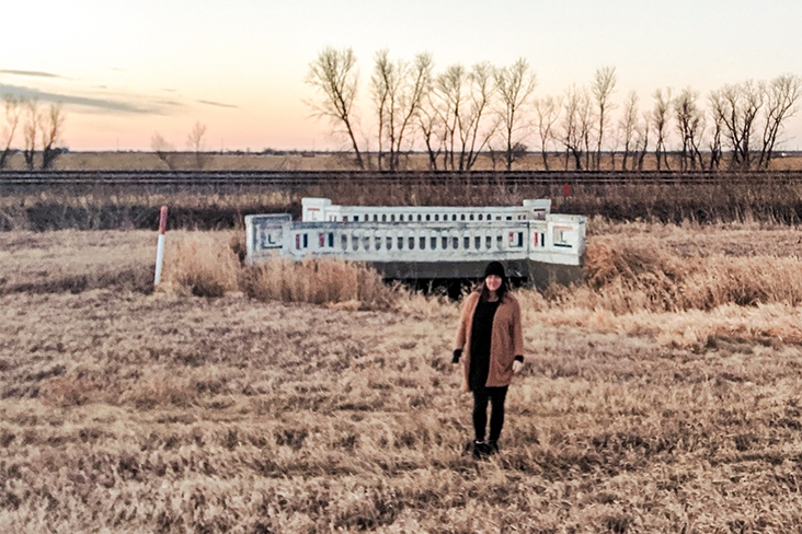
As the freight service chugs away, I snap a photo of one of the original bridges that carried the Lincoln Highway over a small divot in the plains. A pair of red-and-blue L’s emblazon the bridge’s flanks, the same logo that once guided travelers mile marker by mile marker from New York to California. This is one of the first relics of the original highway I’ve seen since departing Denver and driving to the highway’s once famous midpoint in Kearney, Nebraska.
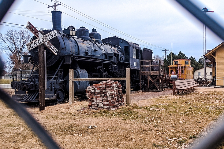
Kearney is a place that owes its existence to a lot of people passing through, a fact honored by the town’s two transportation museums. The Trails & Rails Museum is easy to find – it’s the one with a steam locomotive parked out front.
Even easier to spot is The Archway, once known as the Great Platte River Road Archway Monument, a museum in a skywalk that stretches over I-80, the interstate that now supersedes much of the Lincoln Highway. Here, an exhibit dedicated to the original 1913 route is an homage to how the highway changed the way Americans travel, from the proliferation of gas stations at regular intervals to the invention of motels (a combination of “motor” and “hotel”).
Freed from the structure of the railroad companies, early auto adopters could explore the United States in new ways. These “tin can tourists,” as many called them at the time, stayed not in the large hotels close to rail depots but in modest motor lodges and campgrounds that set the pattern for later Howard Johnsons, Super 8s and KOAs.
Travelers like Emily Post, who in 1916 published By Motor to the Golden Gate, a memoir about driving the Lincoln Highway, were excited to see the American West for the first time, just as the region was becoming mythologized in novels such as Owen Wister’s The Virginian. Entrepreneurs set up roadside attractions, from a coffee shop that looked like a shoe to “the world’s largest teapot” (actually a building with windows for concession sales).
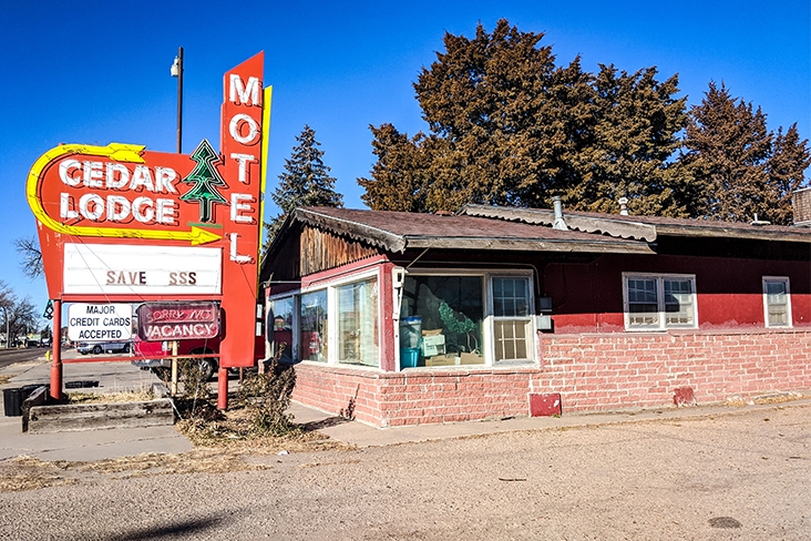
The highway hit the height of its popularity around the midcentury when the federal interstate system was signed into law.
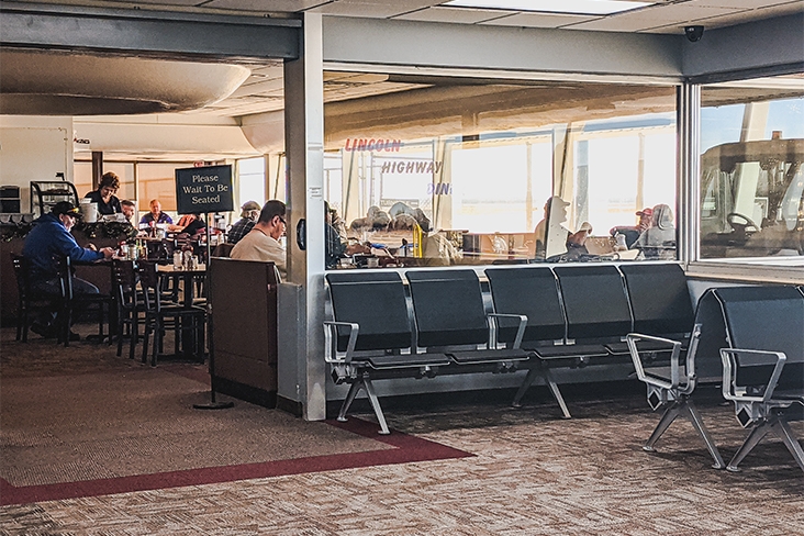
My next stop is a diner from that era, the aptly named Lincoln Highway Diner, in North Platte. My GPS bypasses the original location and navigates to the one at the North Platte Regional Airport/Lee Bird Field, the site of the first night airmail flight.
Brown vinyl booths line the restaurant, and a UFO-like wreath of plaster adorns the drop ceiling over the server station, all very chic in 1952 when this terminal was built. Between bites of hot buttered toast, I overhear locals chatting about spring seed catalogs and teenage drama at the area high school.
Laramie to Medicine Bow, Wyoming
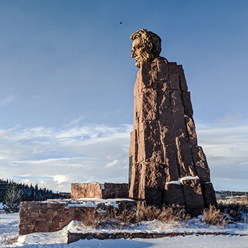
Cruising I-80 into Wyoming, I stop to admire the modernist sculpture of Abraham Lincoln that Robert Russin completed in 1959, now displayed at the Summit Rest Area and Visitor Center in Laramie. I settle in Medicine Bow for the night at The Historic Virginian Hotel, named for Wister’s novel.
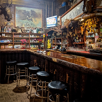
The cook at the hotel bar lets me roam the upper floors in search of ghosts he claims to see on the regular, including a woman in a white dress and a man in a red cowboy hat. None of the supernatural residents reveal themselves to me, but a photo I take of a hallway off the second-floor landing is filled with eerie glittering orbs.
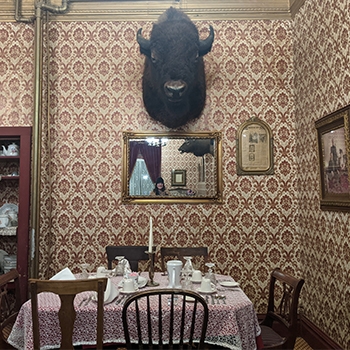
Before sleep, I reflect on the day. Driving I-80, I was grateful for my Crosstrek’s four-wheel drive when a storm blew in from across the Wasatch. Now, I can’t help but think of how Post detoured to New Mexico after her fancy European auto was slowed by thick Wyoming mud.
Post felt let down by Wyoming, anyway. Arriving in Cheyenne, she and her travel companions were expecting saloon doors and false-front clapboard frontier architecture. Instead, they found modern buildings and wide, paved sidewalks. “If you think Cheyenne is a Buffalo Bill Wild West town, as we did, you will be much disappointed,” she wrote.
Like Post, many early travelers of the Lincoln Highway romanticized frontier life and were eager to see attractions like William “Buffalo Bill” Cody’s ranch and his Wild West show, in which he performed through 1916. Today, we know that the mythos of the Wild West is entangled with the takeover of tribal land – a history I can’t overlook as I tour this area.
Fort Bridger, Wyoming, to Ogden, Utah
Leaving Medicine Bow, I head west to Fort Bridger, a former trading post and military barracks, where I learn more about everything that’s passed beneath the Lincoln Highway’s pavement, from the 19th-century fur trapping era to the devastation of the American Indian Wars.
While the Lincoln Highway made cross-country travel more affordable, it wasn’t egalitarian. Black travelers faced the dangers of Jim Crow-era sundown towns, so much so that in 1936 Victor Hugo Green began publishing Green Book travel guides for minority motorists, advising on which gas stations, diners, motels and attractions were safe.
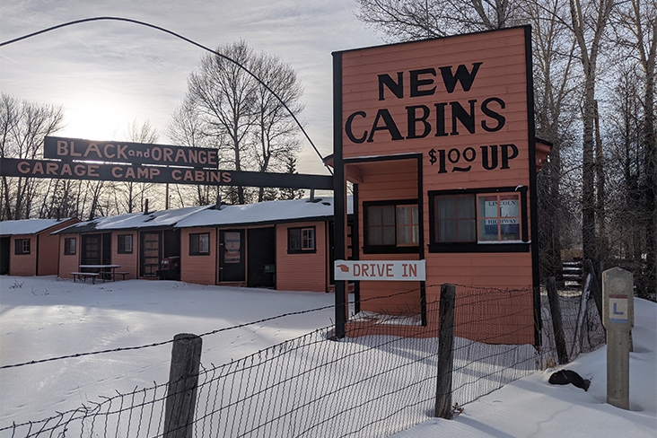
On this trip, I’ve admired the architecture and design of surviving motels, so much richer and more interesting than the white-subway-tile aesthetic marketed by travel apps today. But I wonder: Who did these accommodations welcome in their heyday and who didn’t they?
Laramie and North Platte, among many others, were probable sundown towns according to sociologist James W. Loewen, author of Sundown Towns: A Hidden Dimension of American Racism, and his colleagues, who are continuing Loewen’s research after his death last year.
One of my goals when planning this trip was to get a sense of what the Lincoln Highway means to people today. In Evanston, a 30-minute drive from Fort Bridger, I meet Michael Kindler; he grew up in the area, moved away and, a few years ago, decided to come back.
Kindler converted an old gas station into a bar called the Lincoln Highway Tavern, giving it the Lincoln Highway name not in reference to any previous business at the location but as a tribute rooted in nostalgia.
As I enjoy some truly incredible hot wings, the man on the barstool to my right tells me his name is Keith Richins and that his great-great grandfather, Heber Ralph Richins, had worked at Frank’s, a service station just across the Utah border in the scenic Echo Canyon.
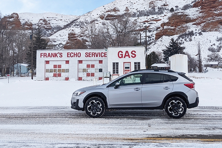
Now just a photo op, Frank’s sits next to another defunct business, the Echo Cafe. The scene helps me imagine the travelers who stopped here to fuel up and eat before continuing on to Ogden and Salt Lake City.
About 40 miles down the road in Huntsville, Utah, is the Shooting Star Saloon, open since 1879 and still thriving. Today, it’s full of locals filling up after a day on the nearby ski trails. I try the Star Burger, which comes topped with an entire knackwurst.
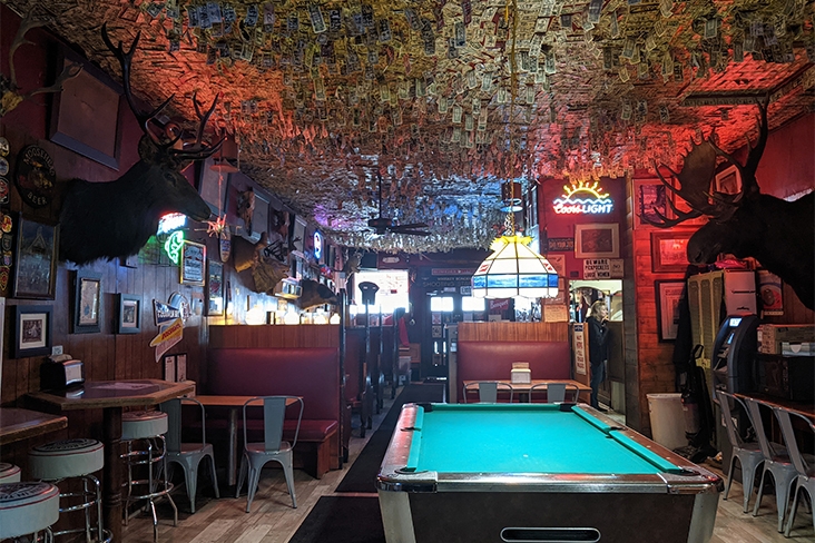
For much of my trip, I’ve had an audiobook of Jack Kerouac’s On the Road riding shotgun. In Ogden, I think of Kerouac as I visit the Kokomo Club on the town’s 25th Street drag. Midway between the Wasatch Mountains and the train station, this still funky former skid row is where the Beat author once caught local greats like Joe McQueen playing dive-bar jazz.
You can still play pool over a couple pints like no time has passed. Just down the street toward Union Station, the vintage cobalt tile around the entrance to the Roosevelt Hotel still advertises rooms for $1.50 and up.
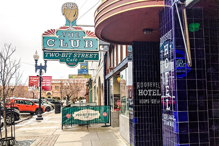
The Lincoln Highway ushered in the American road trip both in practice and as lore before, inexplicably, falling off as a household name. But today, meeting locals and eating burgers and shooting pool, I feel the road’s enduring appeal.
It offers a rare chance to experience a tableau of indie diners, dive bars and period motels. To drive the Lincoln Highway is to see a past that’s both vibrant and flawed, and a present that reminds us that driving from point A to point B can offer more than the monotony of interstate-exit chains. This is a journey that embodies what William Faulkner wrote in 1950 at the height of the Lincoln Highway’s prominence: “The past is never dead. It’s not even past.”
